Map of Ireland, Compiled from the Surveys of the Board of Ordnance and other approved Documents By J. & C. Walker 1838
The Map
| Full Title: |
To Her most gracious Majesty Queen Victoria, This Map of Ireland, Compiled from the Surveys of the Board of Ordnance and other approved Documents By J. & C. Walker, Is with Her Majesty's gracious permission Most Respectfully Dedicated, by Her devoted Subject Edward Holt, Proprietor, By whom it was purchased from the Assignees of William Colling Hobson. |
|
| Slipcase Title: |
Ireland
|
| Publisher: |
Published by the proprietor, Edward Holt, Hanover Street, Liverpool, 1st June 1838.
|
| Seller: |
Sold by J. & C. Walker, 9 Castle Street, Holborn, London.
|
| Date: |
1st June 1838 |
| Size: |
154cm x 124cm (60¾" x 48¾") |
| Scale: |
1": 5¾ English Miles (approx)
1": 4½ Irish Miles (approx) |
| Extent: |
Donegal - Down - Cork - Kerry |
| Description: |
Information about this map coming soon.
|
William Colling Hobson
Information about William Colling Hodson coming soon.
ESTABLISHED 1744.
Mr. LEIGH SOTHEBY has received instructions to sell, unreservedly, on
Monday, the 27th of November, at Twelve o'Clock,
THE ENGRAVED COPPER PLATES
OF
WILLIAM COLLING HOBSON'S
NEW MAP OF IRELAND,
UNPUBLISHED.
This Map, comprsing SIX LARGE SHEETS, is undoubtedly the grandest and most important undertaking illustrative of the Topography of Ireland that has ever been conceived, and in point of beauty of engraving, never surpassed. So minuite, indeed, is the delineation of the various Counties, that the residences of the Nobility and Gentry are most accurately given.
Upwards of 2500l. have been expended upon the work, and it is presumed that an outlay of fifty pounds more upon the Engraving will complete it.
Such has been the opinion of the Work, that above Three Thousand Subscribers' names have already been obtained. |
How To Use These Map Pages
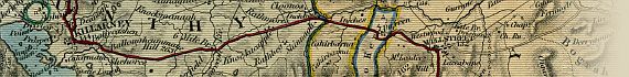
Use the thumbnail map at the top of each page to navigate your way around the map. Hovering your mouse pointer over the thumbnails will highlight the individual sections, and display a pop-up message showing the Counties contained within each map section.
Click the desired area to jump to a page displaying a full size image of that map section. You will need to scroll down the page a little to see the image of the map. A coloured thumbnail image on the thumbnail map at the top of the page will show you which section of the entire map you are currently viewing.
Click To Enlarge
Once you are viewing the desired map section, you can click on the map image to view an enlarged image of that section. Clicking on the map image allows you to switch back and forth ('toggle') between the normal sized image and the enlarged view of the section.
|


, & Tipperary")
, Queen's County (Laois), Tipperary, & Kilkenny")
, Queen's County (Laois), Kilkenny, Kildare, Dublin, Wicklow, Carlow, & Wexford")


